Record#
EV ID |
EV-0004 |
Title |
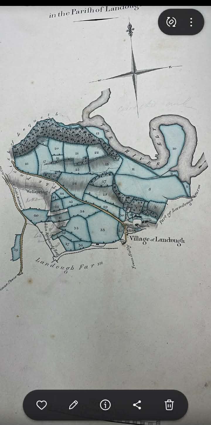
Map of Ty Mawr Dated 1824 (Uploaded Image) |
Date of document |
dated 1824 (unconfirmed whether 1824 is the map date or an associated reference) |
Type |
map/plan |
Evidence label |
PRIMARY DOCUMENT HELD |
Repository / reference |
Uploaded copy held in the Buckler family evidence repository (wiki upload); Original custodian, creator, series, sheet and archive reference not yet identified. |
Status |
HELD — open the scan (image) |
Provenance |
Image titled “1824 map of Ty Mawr” uploaded to wiki media library from Buckler family evidence repository; Metadata and source context unconfirmed. |
Wiki catalogue page |
|
Claims that rely on this |
Evidence Library, GHF-E173 — Cedwyn / Cwm-Cedwyn: complete reference index |
About this page type → Read the Docs
Image: EV-0004 — Map of Ty Mawr Dated 1824 (Uploaded Image)
Quotation: “1824 map of Ty Mawr”
Proves: Repository holds an uploaded image titled “1824 map of Ty Mawr.”
Does not prove: Does not establish creator, scale, sheet, original custodian, actual map date, transcription, modern title, continuous possession, or match to later registered boundaries.
File stored in the wayback archive: EV-0004 in the artifact index.